 Ground Penetrating Radar (GPR) is an electromagnetic technique used to image the subsurface and has many applications including investigating the underlying geology, locating buried objects such as pipes and tanks and mapping peat thickness. Ground Penetrating Radar (GPR) is an electromagnetic technique used to image the subsurface and has many applications including investigating the underlying geology, locating buried objects such as pipes and tanks and mapping peat thickness.
PRINCIPLES
High frequency pulses of radio energy are transmitted into the ground. The transmitted pulses are reflected from material boundaries building up a continuous cross section of the subsurface. Different frequencies are adopted in different situations with high frequencies giving good spatial resolution of features and lower frequencies providing greater penetration to depth.
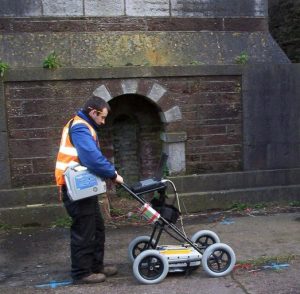
Data are collected by passing the antenna over the surface of the ground/structure with the collection of data controlled by an electronic distance measuring wheel. This allows accurate relocation of individual identified features. This accuracy makes the technique effective in such areas as utility detection and structural assessments. When the velocity of the material under investigation is known, with sufficient calibration, accurate thickness measurements are possible.
RESULTS
 GPR results can be viewed in a variety of ways from simple cross sections to complex 3D generated volumes. Data can be reported on site for immediate results although for more complicated projects, post site processing is often required to give the best interpretation of the data. GPR results can be viewed in a variety of ways from simple cross sections to complex 3D generated volumes. Data can be reported on site for immediate results although for more complicated projects, post site processing is often required to give the best interpretation of the data.
The data above shows the boundary at c. 3m between glacial gravels and the overlying peat. The high amplitude feature shows the location of an underground stream within the peat beds. |
 GPR results can be viewed in a variety of ways from simple cross sections to complex 3D generated volumes. Data can be reported on site for immediate results although for more complicated projects, post site processing is often required to give the best interpretation of the data.